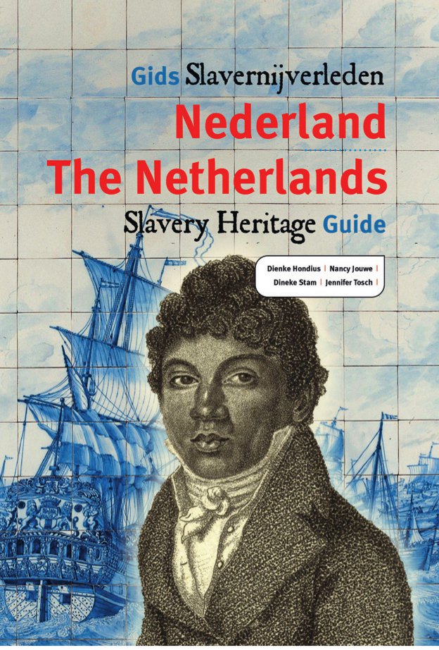
‘’If you start looking into it, you can find in the whole of the Netherlands echoes of that time’’ says project leader of Mapping Slavery, Nancy Jouwe at the publishing event of Gids Slavernijverleden Nederland. ‘’There were no slave markets or plantations in the Netherlands, but you have to see it bigger: it was a system. People could own country houses or estates through the proceeds of slavery.’’ Nancy Jouwe emphasizes ‘’It’s not about who is to blame, or to say how bad the Netherlands was’’. ‘’It’s about giving amenability. It is about history that has lasted two and a half centuries, on four continents. That means something for who we are as Dutch, as a nation. It is not a black page, the whole book is saturated with it.’’
In this blogpost I will analyze the project ‘Mapping Slavery’. Mapping Slavery is a publichistorical project where attention is paid to the Dutch slavery past and associate heritage. The project is funded by several organizations such as the Gemeente Amsterdam, the Prins Bernhardcultuurfonds and the Mondriaanfonds. It also gets funded by organizations which want to make Dutch heritage in the United States more visible to the public. One of these organizations is The Netherland-America foundation. Mapping Slavery is about more than just showing Dutch slavery heritage in the Netherlands but also wants to show that there is Dutch slavery heritage in the United States and Indonesia.
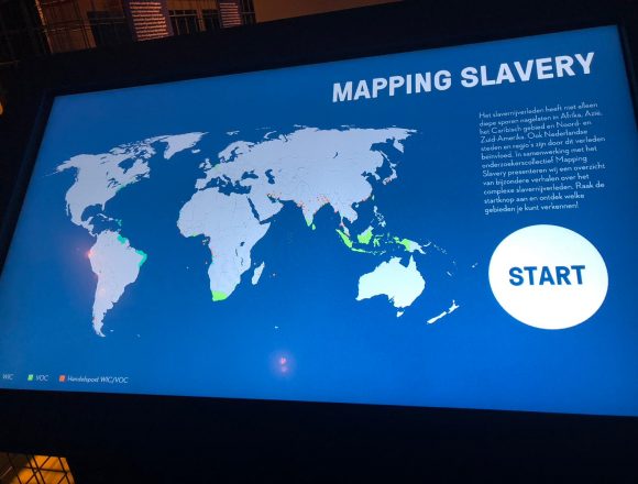
The project is initiated by historian Dienke Hondius of the Vrije Universiteit in Amsterdam. The project leader at the moment is Nancy Jouwe. Working on the project are multiple historians who work on different parts of the project. Due to her project leadership Nancy Jouwe is often asked to give an interpretation and context to current public historical affairs. For example she gave an interview in Trouw when the statue of Piet Hein in Rotterdam was vandalized. The project is benefiting from the debate about Dutch slavery heritage and the people who were involved in slavery. The project gives more context to this heritage and tries to make people see that even in places where you won’t expect it there is a link to slavery. The approach to this project is exactly this, to show people how widespread slavery heritage is nowadays. Through the maps of slavery heritage and it’s online availability it’s a very accessible project. You can make your own walking or cycle tour on the website or just have a browse and look up what slavery heritage is in your neighborhood.
The aim of the project is to make the traces of the Dutch slavery past more accessible for a wider audience. The project is doing this by making interactive maps of different Dutch cities and provinces. In one click you can learn more about different buildings or places that have a connection to slavery heritage. I think this is an great part of their success. By making maps everyone can look in their neighborhood for slavery heritage. It surprised me that there was a lot of slavery heritage in parts of the Netherlands which I didn’t expect to be there. Such as Noord-Brabant, Groningen and Gelderland.
The project gained quite some media-attention. Especially in regional papers findings such as in Friesland get quite some attention. The national media-attention for this project comes through it’s leaders. Nancy Jouwe and Dienke Hondius have given some interviews to give context in the current debate. The media writes quite positive about this project. They write about the findings of the project and don’t write negative about it. Examples are the NOS, Trouw, de Groene Amsterdammer and De Gelderlander.
I think that the strength of this project is in the buildings and places where people walk past in there daily life but never know what the history is of that building or place. Through Mapping Slavery they learn about the history and become aware of the fact that slavery heritage is widespread through the Netherlands. This makes the impact of the project large. Through the finds of this project it creates context in the current debate and by making it very accessible for a big audience everyone can determine their own position in the debate.
What is my opinion on Mapping Slavery?
I think Mapping Slavery is a very good public historical project because it provides a current debate with more context in an accessible way. In my opinion are the interactive maps an enriching for the project because you can browse from your own house and investigate the slavery heritage in your own neighborhood. The strength in this project is the showing of a widespread slavery heritage in the Netherlands. I would’ve never thought that I would find slavery heritage in the rural parts of the province of Groningen.
My biggest criticism of this project is that it has great ambition to find all the slavery heritage in the Netherlands but that got me thinking, is this project ever done? What’s the moment to stop this project? There will be a moment where this project isn’t part of a current debate and it won’t be finished by then. The funding will become an issue I guess. I think this that every public historical project benefits from media coverage and being apart of a current debate. If there’s no media coverage or a current debate projects like this wouldn’t stand a chance to survive for long. You need funding and motivated people to pursue the projects goals. The questions that I find very important for every public historian is ‘when is your project finished?; How do I get funding?; and how do I keep motivated to do this project?’. With Mapping Slavery I think that media coverage won’t die out soon but I think that they need to think about an ending of the project. When is the project finished? By adding more cities and areas in the Netherlands, the United States and Indonesia they are widening the project and there public. I think it’s inevitable that the media coverage and the current debate shift to another topic and before that happens they need to finish the project or extent the debate. They’re working hard on their goal and I guess that they’ll reach it in the end. But when it ends? We’ll see.
For the ones who became curious about this project you can find the project here. You can make your own tour via the site or you can be guided by a guide from www.blackheritagetours.com.
A blogpost by Martijn van den Berg.